How Nubian gold and desert trade routes linked the Nile to the wider ancient world
For thousands of years, caravans crossed the dry landscapes of what is now Sudan, carrying gold, incense, ivory and people between Africa and the Nile Valley. These routes belonged to ancient Nubia, a region that often appears only as a side note to Egypt, yet it was a major crossroads in its own right.
Understanding Nubian gold and trade routes helps explain how ancient communities survived in harsh environments, how they connected distant regions and why control of a few desert tracks could make or break a kingdom.
Where and what was Nubia?
Nubia stretched along the Nile south of Egypt, roughly between the First and Sixth Cataracts of the river. Today this area lies mostly in northern Sudan with a small part in southern Egypt. It contained fertile riverbanks, rocky hills and wide stretches of desert.
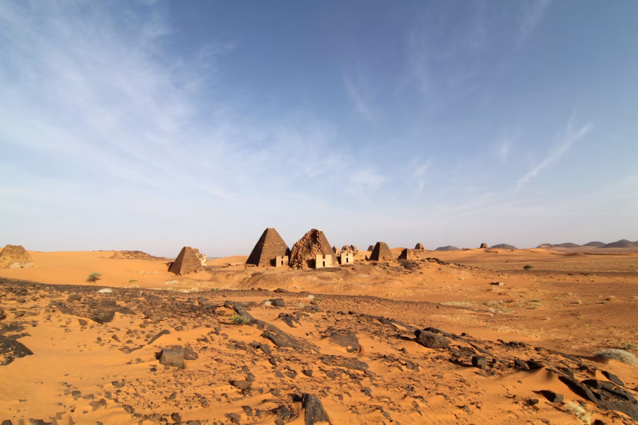
Different kingdoms rose in this region at different times. Names like Kerma, Napata and Meroë appear in inscriptions and archaeology. These were not a single continuous state but a sequence of local powers that drew strength from similar advantages: control of the Nile corridor and access to valuable resources in the surrounding deserts.
Why Nubian gold mattered so much
Gold was one of Nubia’s greatest assets. Ancient sources from the Nile Valley often mention “the land of gold” to the south, and inscriptions from powerful rulers record expeditions that went in search of it. Gold came from deposits in the Eastern Desert and from streams that carried flakes into the river.
Archaeological surveys have found traces of ancient mining: shallow shafts, spoil heaps and grinding areas where ore was crushed. In some places, stone mortars and pounding tools still lie near dusty pits. These remains suggest organized work rather than casual gathering, likely overseen by rulers who claimed the metal as a royal resource.
From mine to market: how gold moved
Raw gold ore was probably processed near the mines to reduce weight, then transported along narrow tracks toward the Nile. From there, boats could carry it north along the river to richer agricultural zones and beyond. Alternatively, some gold followed desert caravan routes directly to Red Sea ports or neighboring regions.
The movement of gold was not only an economic activity but also a political one. When Egyptian authorities or Nubian kings controlled these flows, they could reward supporters, equip armies and commission temples or monuments. Losing control meant losing financial muscle and prestige.
Desert routes: more than empty sand
The deserts east and west of the Nile might look empty on a modern map, but in antiquity they were threaded with paths. Over time, herders, hunters and traders discovered reliable tracks between water sources, then reused and maintained them. What seems like open wilderness actually contained a network of known stopping points.
Key to these journeys were wells and seasonal pools. Some were natural, others engineered with stone linings. Archaeologists have identified prehistoric rock art, simple shelters and ancient campsites near such water sources, showing that people used these places long before organized kingdoms appeared.
What travelled along Nubian trade routes

Nubian routes carried both local products and goods from far away. Not everything came from Nubia itself. The region acted partly as a channel that linked central Africa, the Nile Valley and sometimes the Red Sea region.
- Exports and local products:gold, ivory, animal skins, cattle, incense resins, ostrich feathers and sometimes prisoners of war.
- Imports and transit goods:grain from the Nile, textiles, finished metal objects, ornaments, wine and possibly items that had already travelled from the Levant or Arabian coasts.
The mix of goods changed over time as political alliances shifted and new trade opportunities opened or closed, for example when a kingdom fell or when a port on the Red Sea gained importance.
Who controlled the caravans?
Control over caravan traffic rarely belonged to a single authority for long. Different Nubian rulers, local chiefs and sometimes Egyptian officials tried to tax, protect or redirect trade through their preferred routes. Forts and watchtowers near desert edges hint at this competition.
For travellers, protection was vital. Banditry is known from ancient texts in many regions, and the same risk likely existed here. Merchants might seek escorts, join larger caravans or pay for safe passage. In return, rulers profited from customs duties or gifts that reinforced political relationships.
Life at desert waystations
Waystations along these routes could be simple, just a well and a clearing for tents, or more permanent, with stone structures. Traces of animal dung, broken pottery and fire pits show repeated use. Over time, such sites became familiar landmarks in oral geography and shared memory.
Daily life at these stops would focus on water management, feeding animals and basic repairs. People might trade small items on the side: beads, metal tools, food or information about conditions ahead. Stories, songs and news could travel just as easily as goods.
What archaeology can and cannot tell us
Much of what is known about Nubian trade routes comes from scattered evidence: ruined forts, mining debris, burial sites and objects found far from their likely source. Pottery styles and inscriptions help date activity, while chemical analyses of metals or stones can sometimes trace their origins.
However, deserts also erase clues. Wind, shifting sand and modern development have destroyed or hidden many ancient traces. That means conclusions must stay cautious. When reading about specific routes or exact trade volumes, it is wise to remember that these reconstructions depend on limited data and may change with new discoveries.
What Nubia’s networks reveal about ancient worlds
Studying Nubian gold and desert routes highlights a larger point: ancient societies were not isolated. Even regions that seem remote today took part in wide networks of movement and exchange. Power did not only rest on armies but also on knowing where water lay and how to cross a week of barren ground.
For modern readers, this story is a reminder that maps can be misleading. The blank spaces between river valleys were once filled with tracks, resting places and negotiations. Nubia’s experience shows how people turned difficult landscapes into lifelines that linked distant communities long before paved roads or modern borders.


0 comments